Shale gas exploration gets green light in wetlands, around watercourses
Fredericton – After being alerted to the fact that seismic testing and related work for shale gas exploration is happening in wetlands and around significant watercourses in Kent County, the Conservation Council of New Brunswick (CCNB) has learned that government has granted a blanket permit to do work across wetlands and watercourse buffers in 8 provincial counties.
CCNB was approached by Kent County residents Tina Beers, Harcourt Local Service District Advisory Committee Chair, and her husband John, also with the Harcourt LSD and a volunteer firefighter, who came across activity in a nearby wetland. They were immediately concerned that activity was taking place in sensitive wetland and floodplain areas and started inquiring about the rules for working in and around them.
CCNB requested, and the Department of Environment and Local Government has shared, the wide-sweeping Wetland and Watercourse Alteration (WAWA) permit granted to SWN Resources Canada in April for their seismic exploration program to do work in “various” wetlands and watercourse buffers throughout Albert, Kent, Kings, Northumberland, Queens, Sunbury, Westmorland and York counties.
Ms. Beers was shocked to learn how easy it was for the company to have such widespread access to wetlands.
“We keep hearing that our waters will be protected from shale gas exploration through the strict new ‘Rules for Industry’, she said, “but we look into this issue that concerns us just to find that the province has given the company a green light to go into these sensitive areas”.
“We really want the public to know this,” Ms. Beers continued, “this is a real example of how the “rules” are being applied right now.”
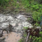
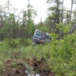
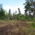
Mr. Beers came across a drill rig stuck in the wetland while out on a fishing trip. A swath of land was cleared larger than allowed as the rig needed to be removed by an excavator.
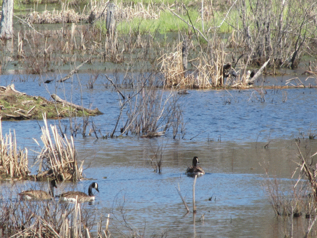
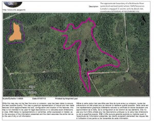
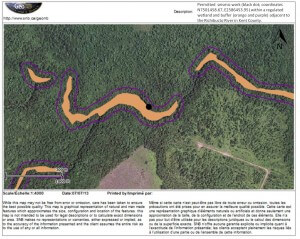
The wetland is about 16 hectares and located roughly ½ km from, with the water drainage connected to, Hector Fork, a tributary of the Richibucto River. Shot hole blasts were also marked less than 40m from the bank of the Richibucto River, an identified wetland area.
“The Rules for Industry” that government is so proud of are permit conditional, like most of our environmental regulations in New Brunswick, says Stephanie Merrill, Freshwater Protection Program director for CCNB. “A proponent can apply for a variance, they write a check for the fee, it’s given the stamp of approval and off they go”, Merrill explained. “Our ‘rules’ are useless if there is no political will to use them for the intended purpose and unfortunately the granting of WAWA permits specifically is very common practice,” Merrill stated.
In addition to granting alteration permits for ‘regulated wetlands” — wetlands acknowledged by the Department of Environment through their GeoNB mapping system, SWN has been actively working in “unregulated wetlands” — not mapped but that still exist on the landscape. These wetland alterations require no oversight from the Department of Environment since 2011 when then Minister of Environment Margaret-Ann Blaney made dramatic changes to how wetlands are regulated in the province.
CCNB has previously estimated that this mapping system only accounts for about 50% of wetlands that exist on the ground and identified 16 examples where wetlands were relieved of their ‘regulated’ status.
“We’ve been saying since these changes were made over two years ago, that the Department is actually in violation of their own Clean Water Act by ignoring these wetlands and relieving them from any protection, permitting, tracking and monitoring, says Merrill. “How can government expect the public to be comfortable with new rules when the old ones aren’t even followed?”
-30-
Media Contacts:
Stephanie Merrill: 506.261.8317; water@conservationcouncil.ca
Tina Beers: 506.785.4348; tinabeers@xplornet.com
Maps that mark the approximate locations of seismic and associated activity by SWN in a two wetlands in the Richibucto River watershed (maps created by using the wetlands layer in the GeoNB mapping portal)
Photos of work in the wetlands:
